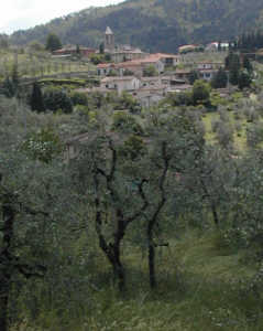
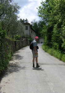
Bagno a Ripoli to San Polo in Chianti


Home | Cinque Terre | Alpi Apuane | Tuscany | Resources | Links
Click the links above to see more information about each region or the link below to return to our HomePage
Main Page with links to hiking and cycling information in other areas


Having spent yesterday visiting the Duomo, Basilica San Lorenzo, and the Mercato Centrale we were ready to explore the countryside. On the way to the bus station we stopped at a magazine store to purchase our tickets. We just told the lady behind the counter where we wanted to go and she knew to sell us the ATAF tickets. The bus lines are well marked, we walked along the row to find the sign with 'our' bus' #33 (every 30 minutes). Soon we had the opportunity to observe the skilled driver manipulate this vehicle through the narrow streets of Florence!

Getting off at the terminal stop in La Fonte, we walked uphill along the main street to the turnoff to Bigallo. Continuing on this little 
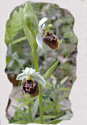
paved road we admired blue iris and red poppies blooming among other flowers. The iris, or Florentine Lily, has been the symbol of Florence for over 750 years. the red iris on a field of white has flown on banners throughout Florence. Even the money of Renaissance Florence, the Florin, displayed the iris on one side.
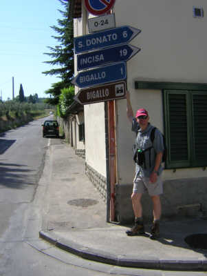
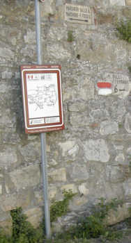
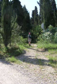
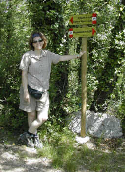
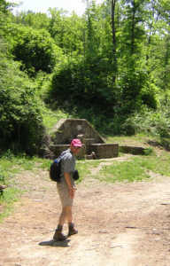
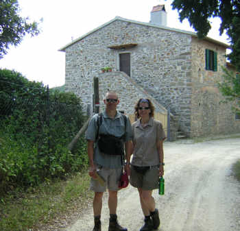
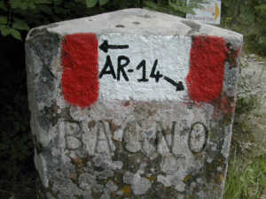
Reaching a large building on the right, we saw our turn marked to the left with a sign and the by now very familiar red-white 
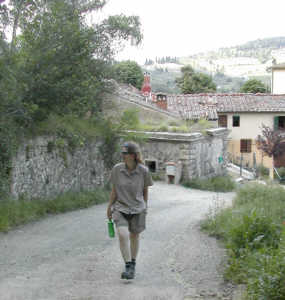
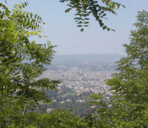
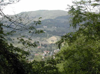
marking. As the pavement ended and the path had ascended , the views of Florence to the left were stunning. We could see the Duomo in the distance.
After turning right we entered a forest and walked along a fenced hunting preserve (Divieto di Caccia signs posted every so often). Once we reached some dilapidated looking buildings and an open area, we had a little difficulty finding our trail, there seemed to be several going straight uphill. We picked one for good luck, turns out we could have picked any as they all joined further up and dead-ended into a paved road. Uphill, yes still uphill for a little ways more and a villa (Monte Pilli) marks the top of this hill. We continued straight and after passing the gated driveway on the far side, the path started downhill.
Wild rose bushes, fields of rapeseed, olivegroves, farmhouses, and tall cedars...Tuscany as we had seen it only in photographs. New Hampshires Poet Laureate (1968) Paul Scott Mowrer once said 'There is nothing like walking to get the feel of a country. A fine landscape is like a piece of music, it must be taken at the right tempo'. We wholeheartedly agree with his sentiment.

Trail #00 turned out to be quite overgrown, we could have put a machete to good use in some places! Soon the trail opened up and we reached the top of Poggio Crociferro with views that seemed to go on forever.

Unfortunately, the path terminates at the main road where we had to walk about half a mile while car whizzed by. But the countryside was feorgeous, olive groves framed the hamlet of San Donato in Collina. This was not our lucky day, just as walked up towards the church, the bar/restaurant hung out its 'closed' sign. We were glad we had packed a lunch, refilled our water from the tap at the corner and found a shady spot for a rest.
P icking up trail #14, we walked up (yes...again) past the cemetary and Casa Gambaraia and into the welcome shade of the forest.


Having our picture taken At Casa al Mandorlo by a couple of passing italian women, we left the red-white trail and soon could see the church San Minato de Rubbiana on the far hill and San Polo in Chianti down in the valley. From here we took the SITA bus (every hour or so, tickets at the bar) back to Florence.


Home | Cinque Terre | Alpi Apuane | Tuscany | Resources | Links
Click the links above to see more information about each region or the link below to return to our HomePage
Main Page with links to hiking and cycling information in other areas