|
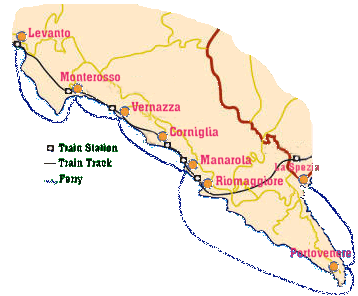
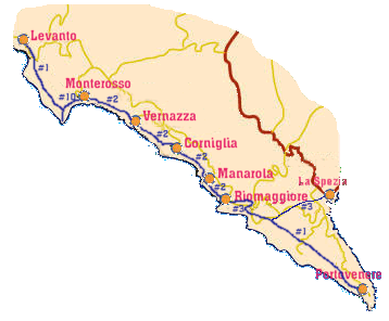
To the left a map showing the train and ferry
routes, to the right a map with the hiking trails and trail
numbers. The paths vary in difficulty, from an easy stroll between
Riomaggiore and Manarola to more challenging hiking, especially
the sections between Levanto and Monterosso as well as between
Riomaggiore and Portovenere. |
|
The name "Cinque Terre" dates
back to before the fifteenth century but the history of the
coast on which the small villages are located dates further
back. Primitive man lived in this stretch of land, bones and
prehistorical tools found support this claim. The ancient Romans
conquered this area by taking it with great difficulty from
the stubborn population of Liguria.
This region demonstrates the challenge of man against a hostile
nature, a conquest that has lasted for more than nine centuries
and requires continuous intervention. |
|
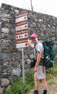
The Cinque Terre is made up of Monterosso,
Vernazza, Corniglia, Manarola and Riomaggiore, they all cling
to the sides and tops of the steep coastline and were only reachable
by boat until well into the 1960's.
The paths are clearly marked with the red and white waymarks
of the Club Alpino Italiano and many directional signs such
as the one seen on the left. |