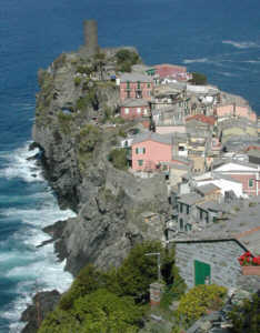
Vernazza to
Riomaggiore |
|
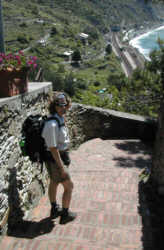
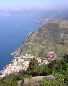
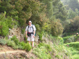
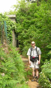
We woke up to sunshine and blue
skies. Pictures do not do justice to the beauty of this region.
We continued on trail #2 'via de l'amore', passing another National
Park checkpoint. If one does not have a 'cinque terre card'
daily fees (3 euro per person in 2005) apply to access the trails.
Going up steep, narrow stairs, Vernazza became smaller and smaller
in the distance. I started to believe that the higher I climbed,
the more steps there were ahead of me.
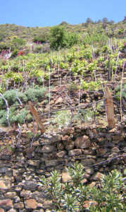
The effort was well
worth it. We were rewarded with incomparable vistas ofthe sea
and vineyards thriving on terraced hillsides
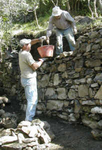
We saw a couple of masons repairing one of the stone walls,
quite hard labor as they also have to access this area on foot.
Working diligently, they are able to repair a 20 square foot
section per day.
|
|
|
|
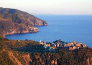
Soon Corniglia was visible in
the distance. This little town differs from other Cinque Terre
villages in that it lies on a hill, surrounded on three sides
by vineyards and olive groves with the fourth side dropping
steeply toward the sea.
A few documents from 1276-77 mention the existence of a castle
of which no remains have been found yet. The only ruin left
is a stronghold on a cliff dating back to approximately 1556,
and belonging to the Genoese fortifications.
After lunch and icecream (gelato ) on the village square, a
long flight of 377 brick steps led us down to the train station
and the rather flat path to Manarola. |
|
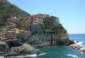
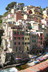
Manarola is perched on a cliff,
with a pretty, partially enclosed harbor. The narrow alleys
("caruggi") lead from one beautiful spot to another.
Above the houses lies a square where the religious buildings
of the village are located. The church, oratory, and bell tower
form a unique area which, even today, is the main meeting point
of the local people.
Here again we found a wonderful store selling delicious gelato
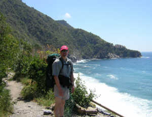
before continuing on to Riomaggiore, our goal for today. The
short walk (less then a mile) between Manarola and Riomaggiore
follows the coast and has been developed allowing people of
all abilities to experience the beauty of this region. We saw
folks in high heels, flip-flops, and some pushing baby carriages.
Just short of Riomaggiore, a rocky path leads down to the sea,
an invitation to dip one's feet into the mediterranean.
|
|
 |
|
Turning the corner, we reached
the Cinque Terre checkpoint and the trainstation in Riomaggiore.
Here an elevator is available to take tourists (free with Cinque
Terre Card) to the upper level of the town. We would have taken
this climbing aid, but found the upper entrance only after we
had walked to town!
The houses are built next to one another and construction material
is of local origin: stones for the walls, slate for the roof,
yellow- or pink-coloured plaster for the facades. The parish
church (San Giovanni Battista) sits high on the hill, overlooking
both the new, modern residential section and the 'old town'.
There is a path leading to a rocky beach, mediterranean water
is very cold and refreshing!
|
 |
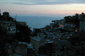
Here again we found
a room in a private home, this time in the new section near
the top of the hill. From our balcony, we watched the sunset
over Riomaggiore.
Dinner on the porch of Ristorante il Gambero (reservations for
outside seating recommended) was a delight; we sampled wonderful
antipasto plates and the local Limoncino, a sweet and tart lemon
after dinner drink. We had walked past this little place while
exploring the harbor and had made a reservation on the spur
of the moment, by the time we arrived for dinner, all outside
tables were reserved and soon filled.
|
|
|
| |
|
Riomaggiore to Portovenere |
|
|
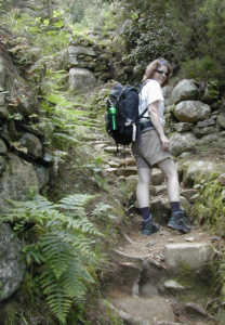
Another morning with blue skies
and sumshine. Trail #3 (not #3a) starts in the sharp left curve
when walking up the main road from the village. Going straight
across, the stone path goes uphill next to a gurgling stream,
crosses a paved road and continues up and into the forest. Soon
Riomaggiore grew smaller and smaller in the distance.
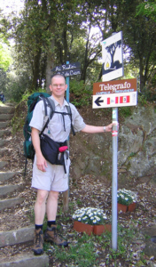
At the church 'Madonna della Monteneri', now a National Park
Information site, we took the path towards Telegrafo. After
passing the last of the cabins, the trail turns sharply right
(#3 and #3a) and continues through vineyards, then along rock
walls and into the forest.
Amid woods of pine and chestnut trees we stopped to admire the
beautiful views.
Elevation gain is 1500+ feet between Riomaggiore and Monte Fraschi.
Several trail meet at Monte Fraschi, here is where we left trail
#3 (which continues to La Spezia) to take trail #1 towards Campiglia
and Portovenere.
|
|
|
|
|
|
|
|

Turning right and passing a bar/snack shop at Monte Fraschi,
we walked into the woods. There is a fitness trail along the
first stretch of the path with multiple different exercise stations.
The path is fairly level here and offered wonderful glimpses
of the sea. Lunch at a bar in Campiglia, then continuing on.
Here the trail was a tad challenging to follow, at first we
passed to the left of the church, then reached an open area.
One tends to want to go straight at this point to follow the
coastline, but trail #1 is marked to the left (sharp turn) with
red and white marks and returns to the paved road. After about
300 feet on the road, the path again goes up to the right and
soon offers gorgeous views of the coast. |
|
|
|
 |
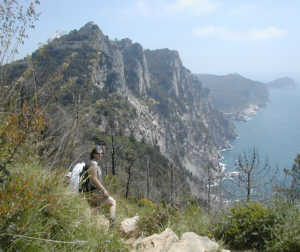
As
this trail narrows and becomes more exposed, the views become
more and more beautiful. There is a sign labeling this section
as 'dificultoso', most likely because it requires a little scrambling
over exposures of rock. Definitely not a trail for high heels
or flip-flops!
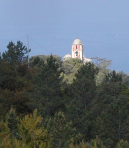
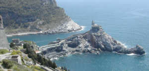
After about 4 hours of hiking we had a birds-eye-view of the
Castello Doria,a 16th century castle. Once reaching Portovenere,
a visit inside leads to an art exhibit and outside to wonderful
vistas of the harbor and sea. There is even a small orchard
with chairs for quiet contemplation while viewing the scene.
|
|
 |
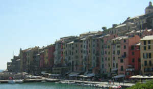
The houses of Portovenere,
up to six or eight stories high, have been standing since the
twelfth century while others are more novel, dating from the
sixteenth. They were built as defense towers directly above
the harbor. When under attack, villagers could exit the rear
of the upper stories for the safety of the castle above.
The 12th century Church of San Lorenzo holds the town's revered
relic, the Madonna Bianca, said to have floated to Portovenere
in the 13th century inside a log.
Once the tourist office reopened we bought our bus tickets to
La Spezia (available here only, there is supposed to be a ticket
machine near the bus stop but we never found it). The posted
schedule lists a bus every 30 minutes and planning to take the
3:25 pm bus, we returned to the bus stop and waited. And waited.
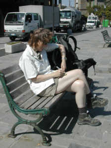
And waited. I caught up in my journal, we waited. Turns out,
there really is not a bus in the afternoon, the first afternon
bus goes at 5:25 pm. That leaves plenty of time to visit the
church and the castle, and partake in some gelato! |
|
|
|
The bus followed a narrow single-lane road
with nice views of the harbor. In La Spezia we exited on the
'Viale Garibaldi' which was lined with hundreds of market stalls
selling everything from produce to T-shirts. Walking about 5
blocks to the train station ( click
here for a printable map) we continued to Massa and the
Alpi Apuane. |
|