
From
Innsbruck to Brixen and through the Dolomites to San Martino di Castrozza

Stage 11 -
Schlüterhütte to Puezhütte
|
From
Innsbruck to Brixen and through the Dolomites to San Martino di Castrozza |
|
Stage 11 -
Schlüterhütte to Puezhütte |
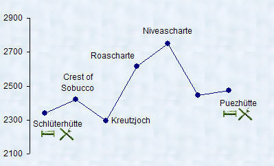 |
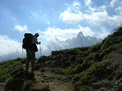
A moderate to difficult 5.5 hour
hike, The path through the Niveascharte is labeled as 'via ferrate' on the
map. It's a 200 meter elevation gain assisted with cables and a ladder.
The initial 20 meters are possible the most difficult. No special equipment
is needed, but surefootedness and a good head for heights are a must. |
 |
|
 |
 |
 |
 |
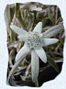
| We saw our first Edelweiss on todays leg. This plant was placed on the protected list in 1878 in Austria, Switzerland, Germany, Italy, and later in other parts of the European Alps.But by that time it had already disappeared along the more popular hiking and climbing routes. If its flowers are picked, the plant is unable to propagate and will disappear from a formerly established area completely. | ||
| Alpine Edelweiss grows only at altitudes from 1700 meters to 2700 meters. Despite its inconspicuous appearance, it is esteemed as a symbol of purity and inaccessibility, as a powerful Talisman to ward off evil, and of course as the 'Ultimate Love Charm' of the mountains. Long ago, love-struck young men would try to endear themselves by collecting Edelweiss from hard to access crags and ledges. The danger-wrought exercise of collecting such a bouquet proved in those days that the suitor was brave, able-bodied, and serious in his intentions. |
 |
 |
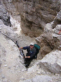 |
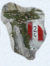
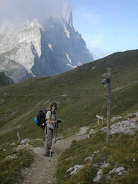
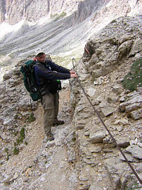
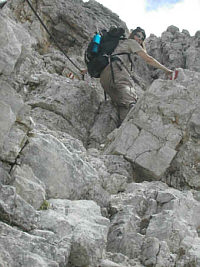
| We chose to take path 2c across the Niveascharte 'via ferrate'. Ralf, our dinner companion from last night, opted for the Forcella Sieles route. Quite a bit of scrambling and climbing, but good footholds and cables in all the right places. There should be only one (1) person on any given secured section at the same time! Also be aware of people above and below you and try not to knock loose any rocks and/or be directly below rocks possibly coming from the person above you. | 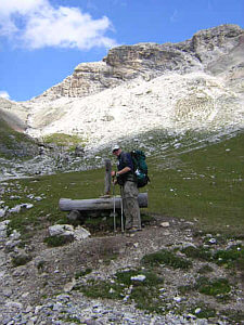 |
|
 |
 |
|
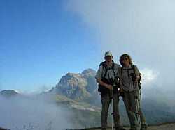
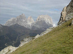
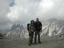
| Fantastic views from the top of the Niveascharte. After joining up with the path coming from the Forcella Sieles, it was about a 30 minute level walk to the Puezhütte. This hut seemed to be a very popular dayhike destinations, there were hordes of people on their way back to the town of Wolkenstein in the valley. We met up with Ralf again, he shared that the F. Sieles route also had a few cable assisted sections. The hut had good food but was a little impersonal with its cafeteria style service. |
| top |