From Innsbruck to Brixen
and through the Dolomites to San Martino di Castrozza

|
From Innsbruck to Brixen
and through the Dolomites to San Martino di Castrozza |
|
| For those contemplating an alpine walking
adventure, detailed information about weather, transportation, food and
drink, language and currency, safety, the hut system, and maps can be found
here. While we have made every effort to provide accurate data, we accept no responsibility for any loss, injury, or inconvenience sustained by anyone using this information. The details provided should be regarded as pointers and in no way are a substitute for your own careful, up-to-date research and maps. The trek from Innsbruck to San Martino is a high route adventure and requires condition, proper equipment , and sufficient alpine skills (surefootedness, knowledge of how to go up and down on cable-assisted trails, etc.). This is NOT a beginners trek, nor is it recommended for children unless they have prior alpine experience. Please see our Berchtesgaden pages for first time alpine hikers. |
| Guidebooks We have not located any english language books covering the Innsbruck to Brixen section. Most guidebooks focus on the Dolomites; the ones for Austria on the Stubai and Zillertal routes, which is to the west and east of our route respectively. |
||||||||||
|
| When to go Alpine weather is unpredictable, unusual snowfall is possible even in August. The likelihood of troublesome snow, however, is less from the middle of July to late September as the snow will clear in about the same time it took to fall. Earlier or later, snow covered passes and snowfields pose a danger to even experienced hikers equipped with crampons and ice axes. The hut wardens (not the serving staff!) are usually experienced mountain guides and can advise you about the conditions of the path you are contemplating; be sure to also ask them about the weather forecast before leaving in the morning. Huts are open with a guardian in residence from late June to early October. |
| How to get there Several airlines fly to Zurich, Stuttgart, Munich, or Milan. Check current prices to decide which choice is the most economical. A valid Passport is required for US citizens. All of these international gateways offer trainservice. Possibly the easiest way to continue on is to purchase a ticket to Innsbruck. Be sure to get a printout of your schedule from the agent. The tourist office at the trainstation in Innsbruck charges for making reservatoins and also for a city map. Ask them for a 'hotel listing' which will include the same map in the back of the brochure for free. Just walk out the front of the train station, turn left, then right, as you walk down this this street you will see many hotels, pick one! Or go ahead and take the 'Igls Bahn' to Igls and pick a hotel there. |
| Food and Drink Tap water is safe to drink, one will also encounter water stations along the trail. If the water is unsuitable for consumption, there is a prominent notice to that effect: 'kein Drinkwasser'. Remember to fill your water bottles at the hut in the morning. P purchase your lunch supplies in Innsbruck, Gries am brenner, Mühlbach, or Brixen. Cheese, bread, and fruit will keep well for several days in your pack Dinner and breakfast are available in the huts. You can also purchase lunch packs from the hut. We have marked locations offering food service along the trail with a knife and fork symbol on the route profiles. |
| Language and currency German is the universal language for this trek, knowing some Italian will also be useful, especially south of the Marmolada area (Trentino). The Euro is the currency on the trail. Automatic tellers are available in Innsbruck (800 max), Gries am Brenner (800 max), Mühlbach (400 max), and Brixen (400 max). Only major hotels will accept credit cards, so plan ahead to have sufficient funds (hut costs are about 40 Euro per person per night excluding drinks). |
| Safety A high number of alpine accidents are contributed to by inadequate clothing or footwear. Make sure you have good hiking boots (well broken in), warm clothing, rain gear, and plenty of water. Trekking poles are highly recommended. A very useful item is a pair of convertible pants, especially the kind one can remove without having to take off one's boots. Try your local outdoor store or REI online. Do not overestimate your physical abilities, and do not hesitate to turn back should conditions change. Stay on the approved trails and never select the 'Via Ferrate' or 'Sentiero difficultoso' option unless you know appropriate techniques and have the necessary equipment. The alpine emergency signal is 6 long blasts at 10 second intervals on a whistle followed by a minute of silence, then repeat. The silence permits a reply which consists of 3 blasts at 20 second intervals. The person being aided must bear all costs of a rescue operation, so give careful thought to blowing whistles on mountainsides. The surest way to a disastrous - even fatal - outcome is to ignore common sense! |
| The Alpine Hut System Membership in an organization is not required to gain access to the huts. Make a reservation at the next hut before dinner from your current hut. The hut guardian will gladly call ahead for you and assure you of a space. Underestimating your planned distance and selecting a closer hut is a better choice. Should you arrive early and wish to go further, just ask that hut guardian to ring the next place for you. Sign the hut register. Hiking shoes are not permitted inside the dormitories, remove your boots and store them in the shoe closet, then either wear your own sandals/slippers or select a set of the rubber clogs provided by the hut. Bring a washcloth and towel, some huts have hot showers for an additional 2 or 3 euro per person. If planning to take shower, ask what time showers are available. Basic sleeping arrangements are dormitory style with mattresses side-by-side, a pillow and two blankets allotted to each space. Sleeping and bathroom facilities are not segregated by gender. One is required to supply one's own 'bedsack' which provides a barrier between one's body and the bedding. Check REI online (search for 'cocoon+sheet') or try your local outdoor store; as always with hiking gear, the lighter the equipment, the higher the price! Printerfriendly hut listing. |
|
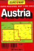
Maps
Maps are generally available in bookstores and at airports. There is
a Freytag & Berndt bookstore 2 blocks from Innsbruck train station.
Ask for directions at the tourist info or your hotel. They can also be
ordered from amazon.de, however, shipping charges to the US are quite
expensive. |
| Links | |