|
|
| For those contemplating an alpine walking adventure, detailed
information about weather, transportation, food and drink, language and
currency, safety, the hut system, and maps can be found here. |
|
|
We used the previous edition of this book. A British couple shared the new edition with us and we could not wait to purchase one ourselves. This edition is up-to-date and provides excellent information about both clockwise and the more traditional counterclockwise routes. Each leg is accurately described with a detailed map and elevation chart. Refuges are listed, giving the hiker information about number of available beds, as well as providing phone numbers to call ahead for reservations. |
|
|
We own several other Rucksack Readers Guides and they have excellent maps, stunning pictures, are informative, waterproof, and fit easily in one's backpack. This new guide should be a nice addition/alternative to the Cicerone Guide by Kev Reynolds described above. |
| |
This is a new book by Hilary Sharp. This author penned the excellent guide listed below and this book should be a resourceful addition with more detailed information for the Mont Blanc Region. |
| |
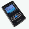
What is an MP3 Player doing here? We received this gadget as a gift and weren't quite sure what to do with it as we prefer the sounds of nature when hiking. Turns out, this guy does a good job of displaying jpeg images (in color no less). We do lots of internet research before a trip and always ended up with tons of pages of printouts (small maps, hut and guesthouse contact info, etc). Now I just use an image capture utility (SnagIt or the free MWSnap) and take a screenshot of the desired info. It took a little while to get the hang of capturing a size that will display well, but now i just capture and organize the data in a folder and before a trip upload the complete folder. Voila, all the info at our fingertips! |
|
|
We probably own more guidebooks on hiking in the Alps than the Library of Congress. This book is one the best if one has not decided on a definite route. A selection of day trips and multi-day treks, beautiful illustrations, pictures, information about flora and fauna, and detailed maps are sure to spur the imagination. If there is a hiker on your gift list, this book will make their heart beat faster! |
| |
The Lonely Planet walking guides provide detailed information and are logically organized. We have used the Italy, Switzerland (TMB not mentioned in it), and Spain guides and have been pleased with the accuracy of the information. This guide includes info about the TMB as well as other long distance treks in the alps. Maps are detailed but we highly recommend purchasing individual maps for the trek selected. |
|
|
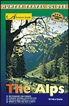
The Alps Adventure Guide is an all-season guide to Europe’s mountains – the best cities, national parks, and resort destinations in the alpine regions of Austria, France, Germany, Italy, Liechtenstein, and Switzerland. This is a more general guide and includes information about non-walking activities such as bicycling and snow sports as well as info about festivals, local history, and reviews of places to stay and eat. |
| When to go Alpine weather is unpredictable, unusual snowfall is possible even in August (see days 3 and 4 of our itinerary). The likelihood of troublesome snow, however, is less from the middle of July to the middle of September as the snow will clear in about the same time it took to fall. Earlier or later, snow covered passes pose a danger to even experienced hikers equipped with crampons and ice axes. Huts are open with a guardian in residence from about July 15th to September 15th. |
|
How to get there |
|
|
| Food and Drink Tap water is safe to drink, one will also encounter municipal water stations along the trail. If the water is unsuitable for consumption, there is a prominent notice to that effect: l'eau non potable. Remember to fill your water bottles at the hut in the morning. As you pass through little towns with stores, purchase your lunch supplies. Cheese, bread, and fruit will keep well for several days in your pack (a wedge of brie was quite tasty after 2 days). Dinner and breakfast (demi-pension) are available in the huts. We have marked locations offering food service along the trail with a knife and fork symbol on the route profiles. |
| Language and currency French is the universal language of the Tour de Mont Blanc. One will enjoy the experience more if one has learned a little basic French before leaving home. In our experience, attempting to speak rudimentary French before asking if anyone speaks English was most successful in communicating.
|
| Safety A high number of alpine accidents are contributed to inadequate clothing or footwear. Make sure you have good hiking boots (well broken in), warm clothing, rain gear, and plenty of water.
Stay on the approved trails and never venture onto glaciers unless you know appropriate techniques and have the necessary equipment. The alpine emergency signal is 6 long blasts on a whistle followed by a minute of silence, then repeat. The silence permits a reply which consists of 3 blasts. The person being aided must bear all costs of a rescue operation, so give careful thought to blowing whistles on mountainsides. The surest way to a disastrous - even fatal - outcome is to ignore common sense! |
| The alpine hut system Membership in an organization is not required to gain access to the huts. Make a reservation at the next hut before you leave in the morning. The hut guardian will gladly call ahead for you and assure you of a space. Underestimating your planned distance and selecting a closer hut is a better choice. Should you arrive early and wish to go further, just ask that hut guardian to ring the next refuge for you. Remember to select 'demi pension' (dinner and breakfast). Hiking shoes are not permitted inside the dormitories, remove your boots and store them in the shoe closet, then either wear your own sandals/slippers or select a set of the rubber clogs provided by the hut. Basic sleeping arrangements are dormitory style with mattresses side-by-side, a pillow and two blankets allotted to each space. Sleeping and bathroom facilities are not segregated by gender. One is required to supply one's own 'bedsack' which provides a barrier between one's body and the bedding. Check with your local outdoor store or shop at REI, search for 'sleeping bag liner'. As always with hiking gear, the lighter the equipment, the higher the price!
|
| Maps The maps located on this web site are intended for general information only. For hiking, one will need two sheets of the 1:25,000 maps published by the Institut Geographique National (IGN). The can be purchased in Chamonix (about 10 Euro each) or one can order them from the IGN web site (about $26.00 including postage, allow at least 6 weeks for delivery). 3630 O.T. - Chamonix & Massif du Mont Blanc 3631 E.T. - St. Gervais-les-Bains a |
|
|

|

|

|
|


